Monday, November 28, 2016
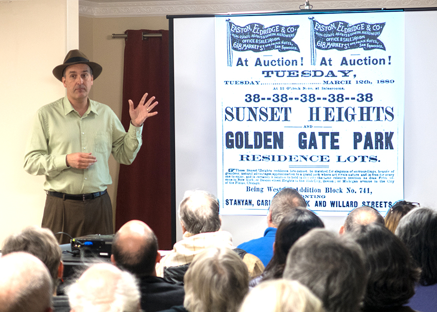
Before there was the Sunset District, there was Sunset Heights, a 19th century hamlet of dairies, hog farms, and roadhouse owners surviving in foggy isolation just west of the bustling city. Woody LaBounty, one of San Francisco’s most engaging and knowledgeable historians, traced the development of our neighborhood from the 1860s to the 1920s. A packed house attended, and no one left until the last question was answered.
At the start of the meeting, SHARP’s outgoing President, Frank Noto, gave a 10-minute review of SHARP’s activities in the last year. We then held our annual elections. We elected Dennis Minnick as President, Frank Noto as Vice-President, Deane Hartley as Secretary, Chooi Eng Grosso as Treasurer, and Jack Barry and Andrew Mihailovsky as at-large members of the Board of Directors.
———
The early history of our neighborhood had at least one thing in common with modern San Francisco: investments in real estate played a big role. But unlike today, it was a buyer’s market. Various events seemed to promise the rapid westward expansion of the city, but development came slowly. Land owners and speculators kept expecting to make a killing but rarely did.
In the nineteenth century, conflicting claims of land ownership plagued the so-called “outside lands” (the area west of Divisadero). The federal government, the city, and private owners (or squatters) all laid claim to property in the area. In 1866, a “grand compromise” finally resolved the disputes. Everyone got something, with the city winning what was arguably the biggest prize, the land that would become Golden Gate Park. With the development of the park, real estate companies bought land nearby and promoted the area in the expectation that it would appreciate in value.
In 1883, the opening of the Park and Ocean Railroad, which ran from Stanyan Street to the beach along Lincoln Way, seemed to further encourage development. But not much happened. Even the area close to the park remained a tiny hamlet.
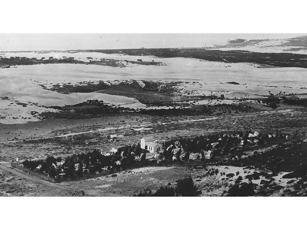
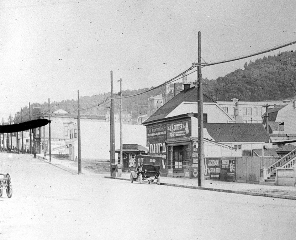
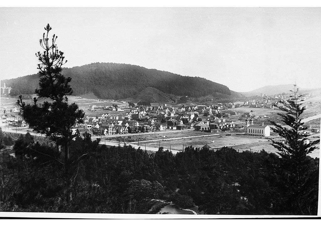
Fewer people still inhabited the hills to the south, the so-called “Sunset Heights.” The name dates from around 1880 and probably came from a developer who, conveniently forgetting the fog, claimed that from the hilltops one could regularly see the sun set. Sunset Heights had two dairies, a hog ranch, a ranch that raised dog puppies, and, at 17th and Ortega, Larsen’s chicken ranch, one of the largest properties in the area. The owner, Carl Larsen, was one of the principal landowners in Sunset Heights.
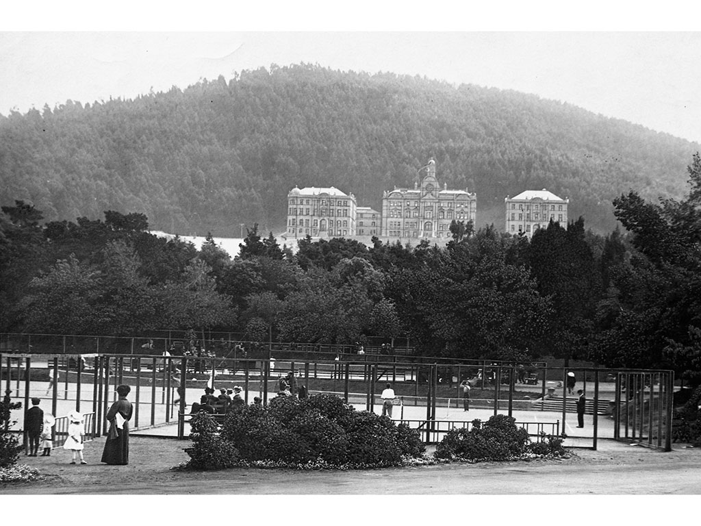
A dynamite factory stood at 2nd and Irving until 1877, when it closed after blowing up for at least the fourth time. The explosion shattered windows as far away as the Almshouse, the city hospital that is today Laguna Honda Hospital.
In the 1880s, Adolph Sutro began buying real estate on the west side of San Francisco. His purchases included Rancho San Miguel, the old Mexican land grant area from which the land for the Almshouse was carved out. Among other tracts, Sutro owned the hilltop where UC Medical Center now stands, an area he renamed “Mount Parnassus.” Sutro planted eucalyptus trees all over the west side, including Mount Sutro (creating Sutro Forest) and Mt. Davidson. In 1892, the San Francisco Call reported that Sutro was “said to be the largest land owner in the peninsula.” Sutro may have owned up to one-tenth of the land in the city. In 1895, he was elected mayor (the city’s first Jewish mayor), but he lasted only one term. (His short-lived political career is a long story.)
In 1892, a streetcar line came to the Inner Sunset. In 1894, the Midwinter Fair in Golden Gate Park successfully recycled the spectacularly successful World’s Columbian Exposition in Chicago from 1893. The success of the Midwinter Fair again promised development of the Sunset, but again the people did not come.
It wasn’t a particularly good neighborhood. In 1895, a civil grand jury complained about goings-on at the Milk Punch House, a bar next to a school that is now the site of Independence High School, at 7th near Irving. The Board of Ed blew off the complaint, noting that the “milk punch” at the Milk Punch House was quite tasty. (The drink had a punch but not from milk.) In the neighborhood at the time, saloon owners had more political punch than did good government types. One of the neighborhood pubs, the Little Shamrock (on Lincoln near 9th), still stands.
The corner lot at 9th and Lincoln, the site of the Parkview Hotel, sold for $4,000 around the time of the Midwinter Fair, but that sale was the rare case of rapidly appreciating real estate in the area.
In destroying many homes in the city, the 1906 earthquake created many potential buyers for property in Sunset Heights, yet business here remained slow. Would-be buyers were discouraged by the lack of water service, fire-fighting facilities, sanitation, and transportation. (Wind, fog, and drifting sand might have had something to do with it, too. Woody noted that the sand in our neighborhood comes from the ocean.)
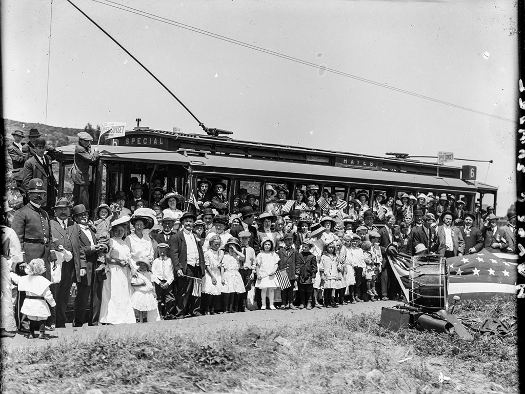
To press city government for infrastructure such as sewers and fire hydrants, residents of the area joined real estate interests to form “improvement clubs.” The Sunset Heights Improvement Club was the forerunner of SHARP. City Hall responded. In 1912, the #6 streetcar (the forerunner of today’s #6 Parnassus bus line) began service to Sunset Heights. Running up the hill to 9th and Pacheco, the line was dubbed “the streetcar to the stars” because passengers could ride all the way to the heavens. The language of real estate hype is not new.
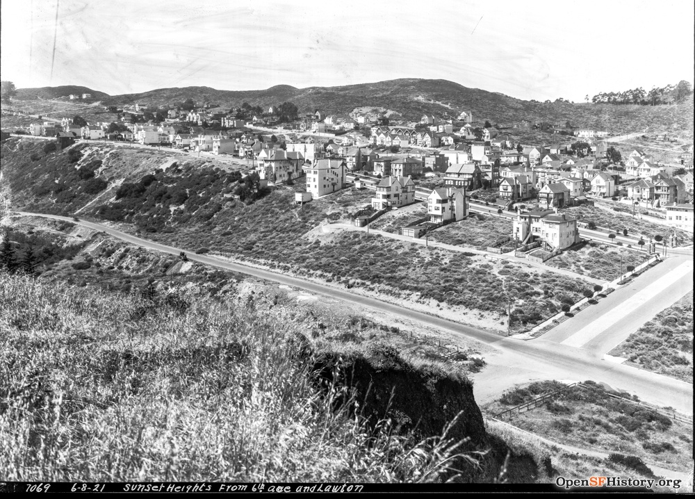
In 1928, the N Judah opened — the first municipal railway line to the area. Some 30,000 people showed up to celebrate. The Roaring Twenties had arrived, and finally, Sunset Heights was booming. But that is another story. Stay tuned for Woody’s return. . . .
—–
No one knows more about the history of the west side of town than Woody LaBounty, award-winning author, raconteur, and founder of the Western Neighborhoods Project, an ever-growing trove of information and images about the city, particularly the west side. A circus performer in his youth, Woody knows how to educate entertainingly. He gave us an evening of history as it should be told: insightful, informative, and fun.